AgroByte Case Study: Counting Flower Plants on 55 Acres of Nursery
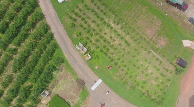
Last week we mapped a 55 acres of flower farm in Ringoes, NJ. This nursery has 5 different kinds of flowers: winterberry, lilacs, viburnum, quince and plum.
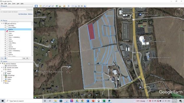
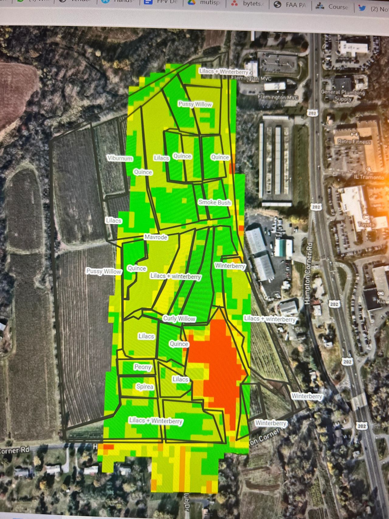
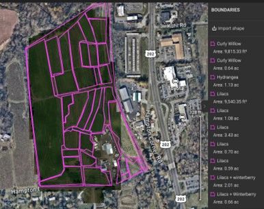
Before collecting data, we use Google Earth to draw the farm’s polygons. This kml file helped us study this multi-flower nursery. After doing this, we used Pix4DFields, to generate satellite imagery from Sentinel-2 satellite and be able to have an idea of the crop health before arriving at the farm.
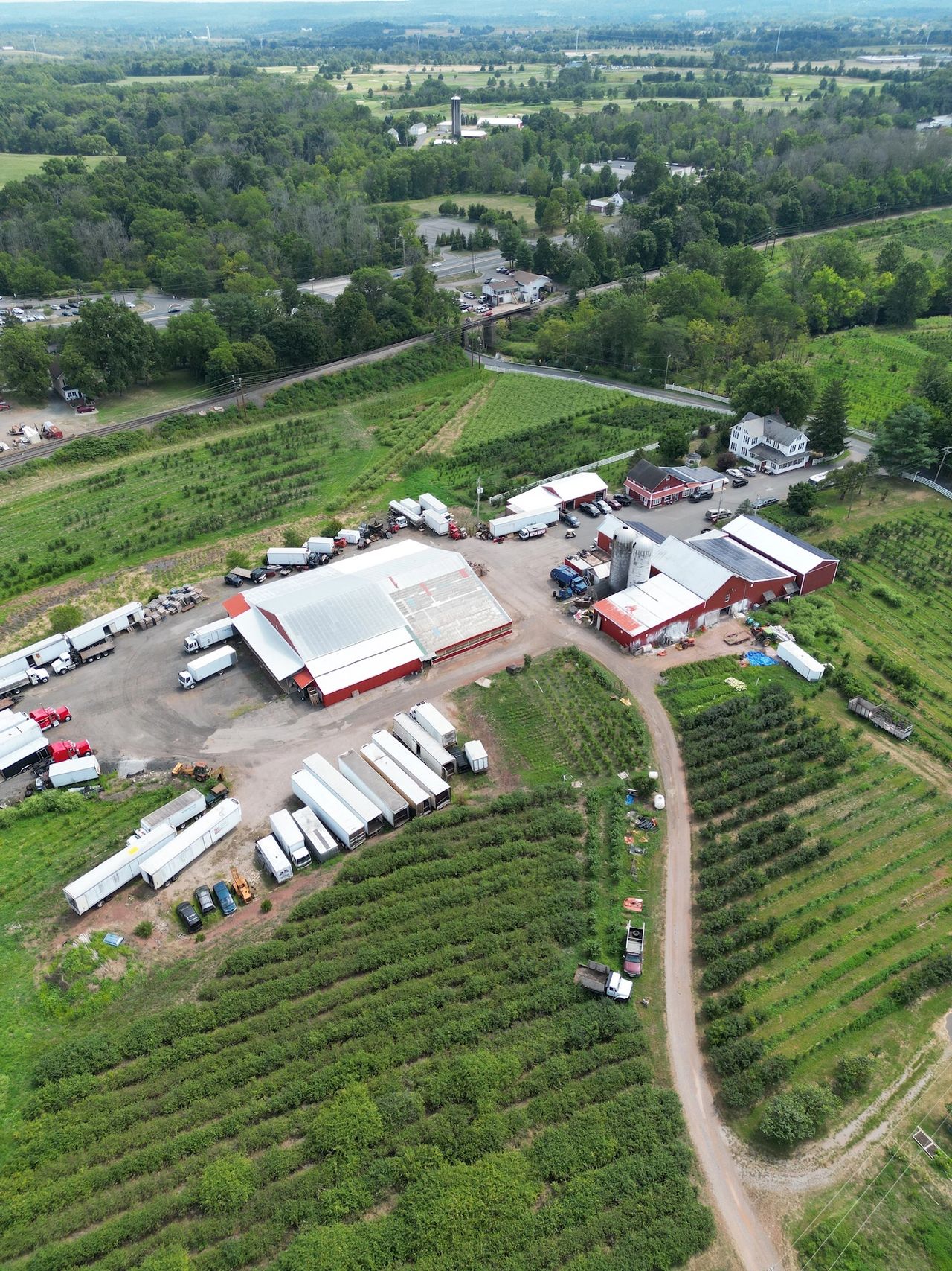
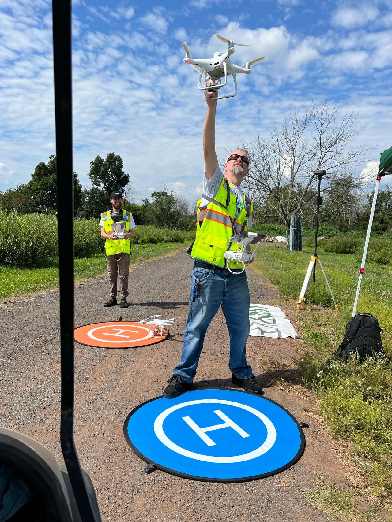
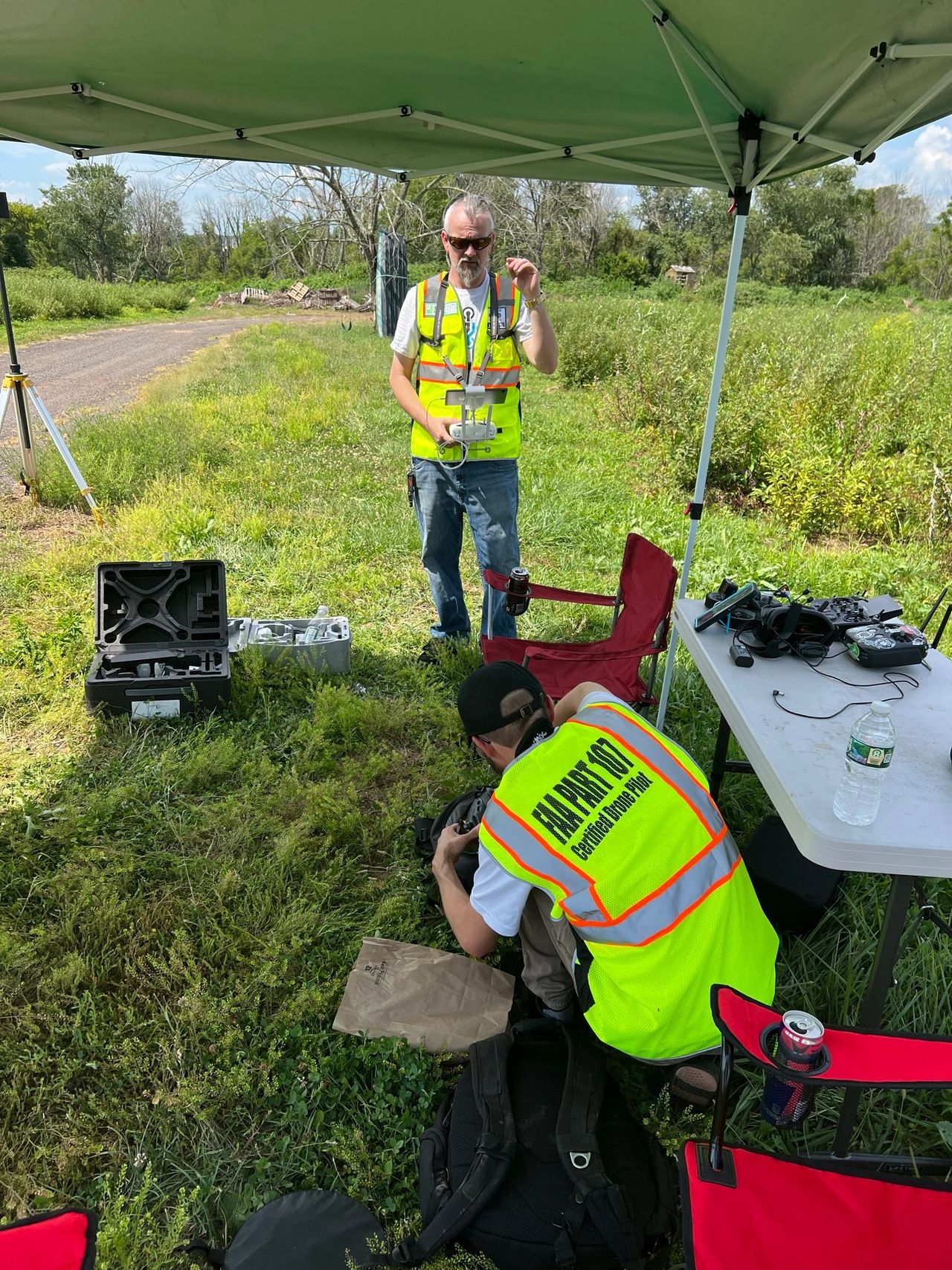
Once at the farm, we first used a Phantom 4 Pro V2 to collect the RGB imagery over the 55 acres. We gathered almost 1,000 images using 4 batteries. This RGB imagery let us have a better understanding of the farm by creating orthomosaics and 3D models out of it using Drone Deploy.
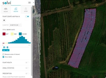
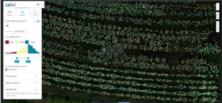
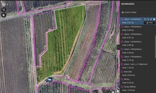
Later, we uploaded all of our datasets to Solvi Agro software. We imported our kml polygon and then with the help of machine learning and AI, Solvi platform allowed us to count the exact number of plants per type of flower.

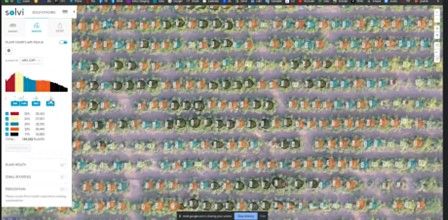
We also collected multispectral imagery using our Phantom 4 RTK Multispectral along with the D-RTK 2 High Definition GNSS Mobile Station.
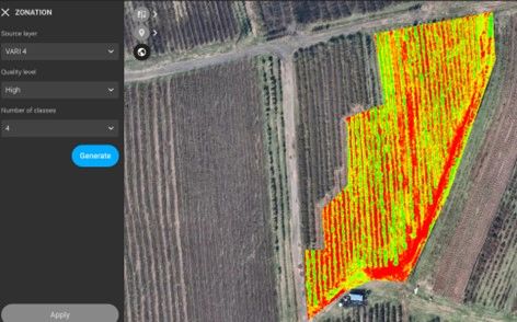
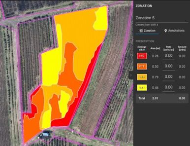
We uploaded and processed this data using Pix4D Fields where we were able to generate vegetation indices to monitor the health of the crop. Later, we generated prescription maps for variable rate spraying applications for a most precise way of spraying saving time and money.
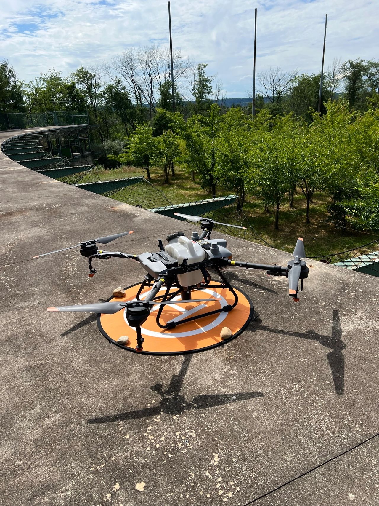
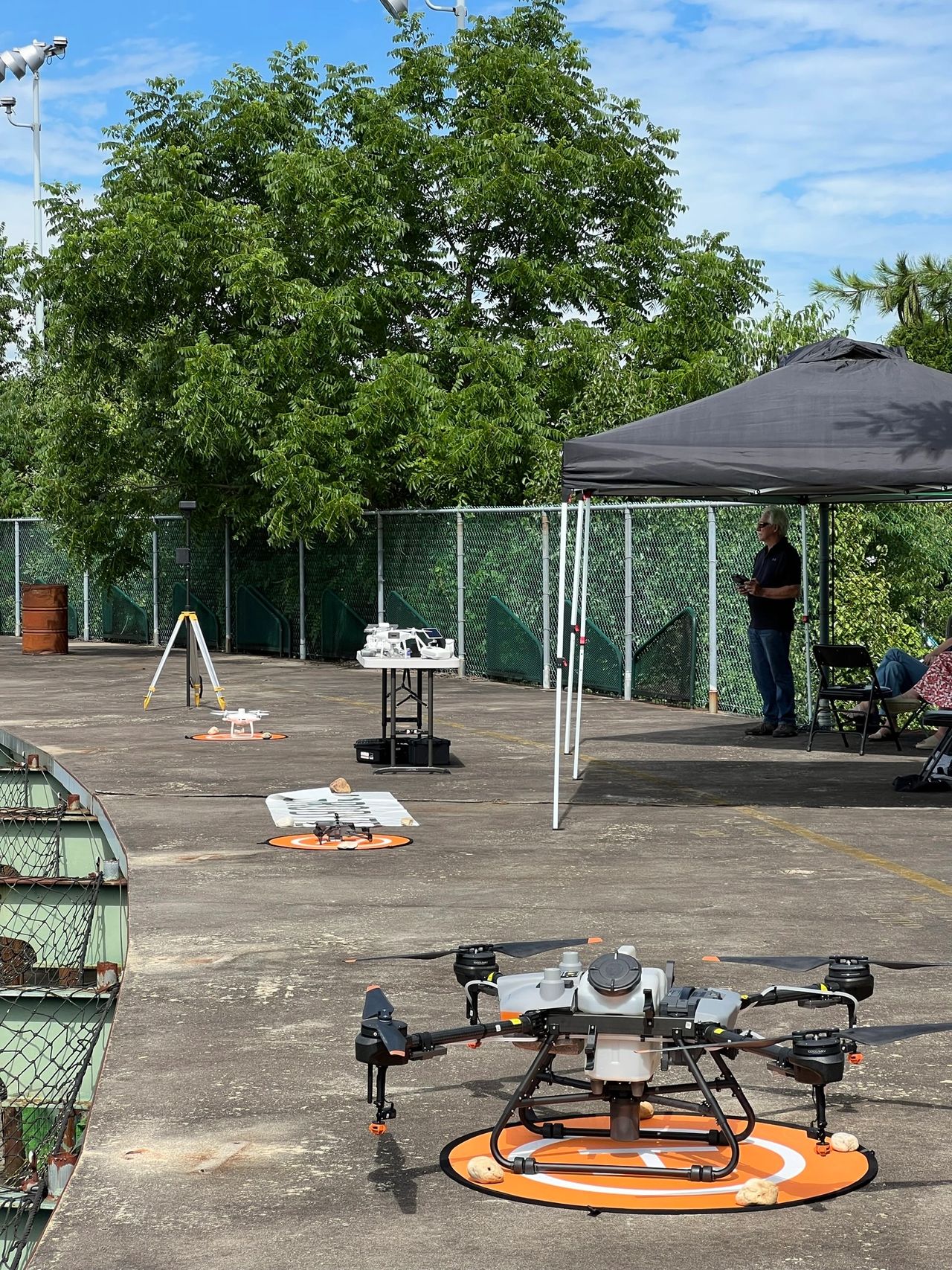
Now with all this information, we can spray quickly and efficiently using our DJI Agras T10 RTK spray drone.

Drones are here to stay. The development of this technology in the past 5 years has been beyond outstanding. Every month new “drone software” and “drone hardware” is released. Drones in farming have been around for a while, however, they are still very far from being mainstream. It is still hard for a 65-year-old farmer to try different ways of farming, however, the next generation is ready to take over. They want to manage their farm in the most automated way possible from a cool office on site or remote, where they can have a wider understanding about the health of their crops. The use of drones has demonstrated an increase of up to 30% of the yield of the crops if used correctly. Drones, satellites, and AI are going to be needed to feed the world in 2050 when we reach 10 billion people. If we keep farming, the way we have done in the past, we will never be able to feed the whole population after 2050. If you want to learn more about digital farming and drones in agriculture, follow us on our social media, send us an email, or call us.
https://agro-byte.com/contact-us