Uplift Drones Introduce Drone Mapping & Photogrammetry eLearning Course
Uplift Drones, the UK’s leading commercial drone training provider, has expanded its training portfolio with the launch of the ‘DroneMAP’ Drone Mapping and Photogrammetry eLearning Course.
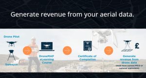
The DroneMAP course is for drone pilots and those involved in surveying who want to know how to collect accurate data and produce accurate data outputs using drones and photogrammetry.
The online course is designed by industry experts who have a proven track record in producing high value survey grade data using drones. The course is built on years of proven commercial experience and will provide students with the foundation knowledge to start producing accurate drone mapping and survey outputs. The course will not teach individuals to be a surveyor, but it will teach drone pilots and surveyors alike the processes involved in collecting of accurate data for drone surveys.
From digital photogrammetry to aerial data capture, processing, extraction and accuracy, the DroneMAP course will teach students to confidently plan and perform efficient drone surveys. They will formulate a strong understanding around the core functions within photogrammetry software, gaining the ability to produce 2D maps and 3D models from valuable data sets. The course is not a “how to guide” for any particular photogrammetry software package – but instead explains the key workflows behind any drone photogrammetry project using examples from the main software packages.
Structured across 13 modules, the course syllabus is delivered by our web-based Learning Management System that tracks student’s progress through each module. The course platform is accessible on multiple devices including tablet, Apple Mac and PC. The course contains over 60 videos, plus text and interactive content, and is approximately 10 hours work. A certificate is issued on completion.
DroneMAP eCourse Curriculum:

This online course is ideal for:
Commercial Drone Pilots
Professional Surveyors
Roofing Specialists
Building Contractors
Who want to:
- Expand your knowledge base and skill set
- Increase your employability with drone surveying
- Generate revenue from aerial data
- Take your career to the next level and boost your business
Course Includes:
- Interactive eLearning Modules
- Practical Survey Demonstrations
- Certificate of Completion
- 6 Months Access to eLearning Hub
- Lifetime Support from Industry Experts
To learn more visit https://www.upliftdronetraining.com/courses/mapping-course/