UK consortium reveal blueprint to build 165 mile drone ‘Superhighway’
World’s longest drone corridor will link towns and cities in the midlands to those in the southeast
London, UK: A consortium led by Reading-based UTM (Unified Traffic Management) software provider Altitude Angel, are planning to build the world’s largest and longest network of ‘drone superhighways’ which would link towns and cities across the UK – initially connecting the Midlands with the Southeast and those urban conurbations along the UK’s south coast.
The consortium has submitted plans for a ‘165 miles (265km) drone superhighway’ connecting airspace above cities including Reading, Oxford, Milton Keynes, Cambridge, Coventry, and Rugby.
If the plans are approved there is an option to extend the superhighway to Southampton on the south coast and Ipswich on the east coast.
The blueprint for the superhighway, known as Project Skyway, will enable businesses to develop and grow through the commercialisation of new and innovative drone-based products, processes, and services.
A decision on whether to green light the project is expected in the coming weeks.
“This is the most ambitious transport project proposed for the country since the advent of the railway network in the 18th century,” said Richard Parker, Altitude Angel, CEO and founder. “Britain is at the forefront of a second transport revolution. Drones have the potential to transport goods in a way our ancestors could never have imagined but would have surely understood. Britain can lead the world in these innovative and life-saving technologies, we have the skills and ambition to open our skies to safe and secure drone and air-taxi flights.
“With the government’s support, using this technology as its foundation, we can create networks spanning the length and breadth of Britain, a super-highway-network-in-the-sky, providing a critical digital infrastructure which will, in-turn, enable the world’s first truly national drone economy.”
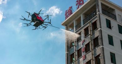
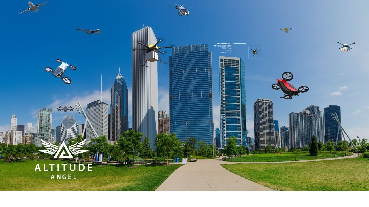
Using detect and avoid (DAA) technology developed on the five-mile (8km) Arrow Drone Zone built by Altitude Angel south of Reading, the Skyway superhighway network will help unlock the huge potential offered by unmanned aerial vehicles and be a catalyst to enable growth in the urban air mobility industry.
Unlike existing drone corridors or research facilities which restrict access to operators by imposing punitive financial barriers to fly, the superhighway will be able to support fully automated drone flights beyond visual line-of-sight (BVLOS) from any drone company which completes a series of basic technical integrations which, crucially, don’t require specialist hardware on-board the drone.
Congestion in the first 1000ft is predicted to increase, becoming the densest area of airspace as it evolves through the use of unmanned, General Aviation (GA) and other civil aviation. Project Skyway technology will permit ease of access, while monitoring deconfliction, without the need to close airspace as is the case today.
Skyway partners will collaborate to deploy the DAA solution, where possible on existing infrastructure, in combination with Unified Traffic Management (UTM) software-as-a-service, to enable greater awareness of manned and unmanned traffic to all stakeholders.
By connecting the towns and cities along the superhighways, businesses, and organisations within them will be able to utilise and adopt the technology, empowering them to grow, and deploy drones in a safe and repeatable manner.
The UTM will enable flight requests, approvals, deconfliction and provides a single-source-point-of-truth for all traffic on the Project Skyway corridors through combined manned and unmanned situational awareness. Project Skyway makes this combined air picture available to larger groups of airspace users through existing solution providers, such as those providing existing planning and tracking products to, e.g., GA and commercial air transport.
Once the initial UK highway is established, Altitude Angel will make available the technology to allow any organisation, airport, town, or city in the UK or beyond, which wants to establish and operate a ‘superhighway’ to do so quickly, easily, and cost-effectively through a simple licencing agreement.
About Altitude Angel:
Altitude Angel is an award-winning provider of UTM (Unified Traffic Management) software, enabling those planning to operate, or develop UTM/U-Space solutions, to quickly integrate robust data and services with minimum effort.
From a consistent, well-documented and standards-based platform, drone manufacturers such as DJI and cutting-edge software developers around the world use our Developer Platform to obtain rich, relevant, and local geofencing data, exchange and share flight plans, de-conflict their own flights in real-time and interface with national flight authorisation systems. A growing portfolio of enhanced capabilities help our customers to comply with current and future regulations and interface with changing national systems with only minimal effort.
Altitude Angel’s first party solutions also power some of the world’s leading ANSPs, aviation authorities and Enterprises, including LVNL (Netherlands) and Avinor (Norway), empowering them with new capabilities to safely manage and integrate drone traffic into national operations.
Today, Altitude Angel’s market-defining technology is providing a critical, enabling service on which the future of UTM, especially in controlled airspace, will be built across the globe.
By unlocking the potential of drones and helping national aviation authorities, ANSPs, developers and enterprise organisations, Altitude Angel is establishing new services to support the growth in the drone industry.
Altitude Angel was founded by Richard Parker in 2014 and is headquartered in Reading, UK.
Altitude Angel’s developer platform is open and available to all at https://developers.altitudeangel.com
About GuardianUTM:
GuardianUTM enables drone manufacturers and software developers to connect into a rich, dynamic source of accurate, authoritative, and relevant information to support geofencing, while offering enhanced UTM capabilities such as a single interface to multi-country flight authorisation.
Its companion product, GuardianUTM O/S, supports all the functionality required to deliver national-grade drone traffic management capabilities to any country that wishes to safely unlock the potential of drones.
Introduction video: https://www.youtube.com/watch?v=Bd0pvUrS07g